Cycleways is compiling a set of suggested cycling routes and cycle rides. There are links to the official WCC routes, but we would like to build a comprehensive set of routes and rides from Cycleways members and supporters. Where possible, we would like suggested rides to be accompanied by a GPX file that can be downloaded to a GPS device. If you would like to submit a ride or route, please send it to admin@cycleways.org.uk. Please supply:
- A short description
- The length of the ride
- An overview map
- Where possible, a GPX file
Joe’s cycle routes
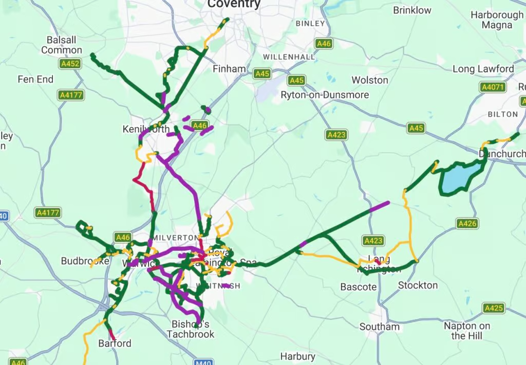
Cycleways member, Joe Dimambro-Denson, has compiled an online map of nice routes that are either low traffic or on separate cycleways. It also shows funded projects planned to happen in the “near” future. This will help give a clearer idea of what’s happening and, more importantly, how it all links up as a network. Joe intends to update it as things progress.
The different “layers” can be switched on and off for clarity.
Joe has included routes that lead somewhere significant, e.g. parks, stations, shops, major housing areas, nearby towns/ villages.
The map is based on the areas Joe knows, but he would like to add suggestions from other members. If you know of routes that could usefully be added, please send the details to: joe.cyclingstuff@gmail.com
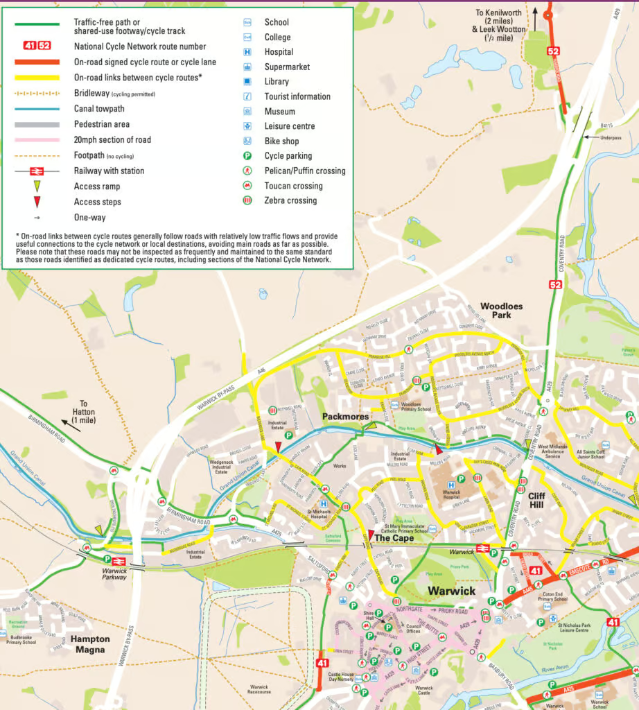
WCC’s Cycling Routes
The County Council publishes a set of cycle routes for different areas of the county. These include on and off-road routes, bridleways where cycling is permitted, canal towpaths, 20mph zones, and access ramps.